North American Protected Areas, 2021
Map type: Marine Ecosystems
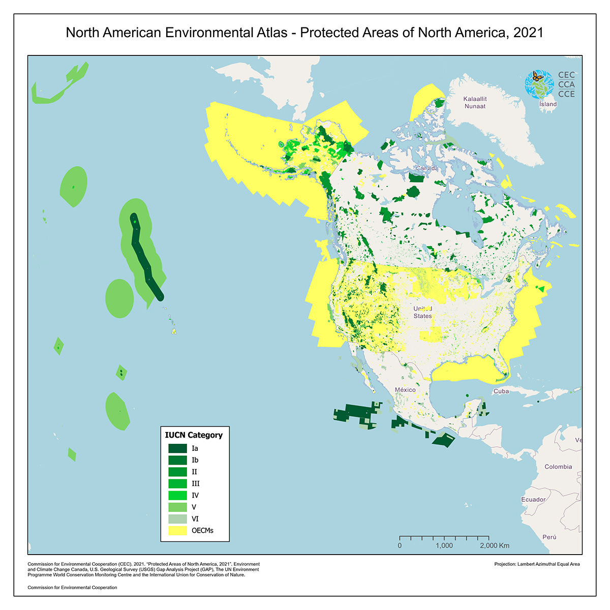
The new map of North American Protected Areas is an update of the map published in 2017 by the Commission for Environmental Cooperation.
This new map integrates the most recent databases available as of August 2021 in Canada, the United States and Mexico.
As defined by the International Union for the Conservation of Nature (IUCN), a protected area represents: “A clearly defined geographical space, recognized, dedicated and managed, through legal or other effective means, to achieve the long-term conservation of nature with associated ecosystems services and cultural values.”
This new version is delivered in two vector layers of spatial information, a layer that shows all the areas that have been categorized in the International Union for Conservation of Nature (IUCN) classification scheme, and a layer with other effective area-based conservation measures (OECMs), areas that do not meet the formal definition of protected areas but are managed in a way that conserves biodiversity over the long term and are subject to special protection.
The main data sources for this new map are the Canadian Protected and Conserved Areas Database (CPCAD), the Protected Areas Database of the United States (PAD-US), and the Mexican protected areas reported by the World Database on Protected Areas (WDPA).
This map shows protected areas categorized according to their management objective, based on IUCN’s classification system, as follows:
Ia. Strict Nature Reserve (managed mainly for science or wilderness protection)
Ib. Wilderness Area (managed mainly for science or wilderness protection)
II. National Park (managed mainly for ecosystem protection and recreation)
III. Natural Monument or Feature (managed mainly for conservation of specific natural features)
IV. Habitat/Species Management Area (managed mainly for conservation through management intervention)
V. Protected Landscape/Seascape (managed mainly for landscape/seascape protection and recreation)
VI. Protected area with sustainable use of natural resources (managed mainly for sustainable use of natural systems)