Human Influence
Pollution
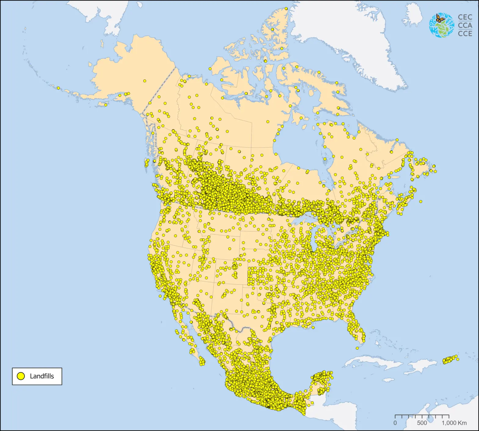
The North American Landfills dataset represents the approximate location of known landfills and dumpsites (open and closed) in North America, based mostly on governmental data from Canada, Mexico, and the United States.
Multiple sources of information were used to find the location of landfills in North America, especially for Canada. All data sources are acknowledged and referenced in a document accompanying the map files.
An interactive map also allows viewers to visualize and contextualize the location of landfills in North America with satellite imagery.
Questions about the North American Environmental Atlas? Contact:
Orlando Cabrera-Rivera
Head, Environmental Quality