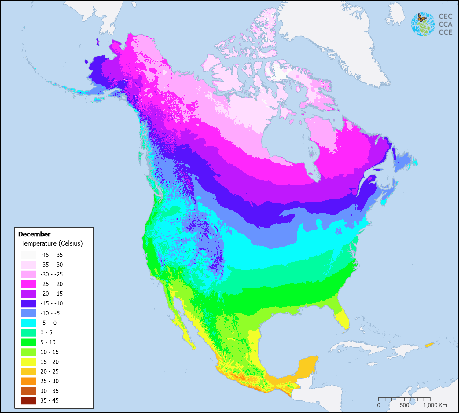
Temperature (1981–2010) – Monthly
Map type: Climate
The Monthly Mean Temperature dataset consists of 12 raster files, one for each month, representing mean temperature values for the 1981–2010 reference period.
These monthly temperature layers characterize the thermal regime of North America throughout the year and support a wide range of ecological, environmental, and climate-related analyses. They provide baseline climatological conditions essential for species distribution modeling, land cover interpretation, climate impact assessments, agricultural and forestry applications, and hydrological modeling.
The North American monthly temperature layers were derived from the CHELSA-climatologies v2.1 dataset, a high-resolution global climate product developed by the Climatologies at High Resolution for the Earth’s Land Surface Areas (CHELSA) initiative hosted at the Swiss Federal Institute for Forest, Snow and Landscape Research WSL.
Contact
Questions about the North American Environmental Atlas? Contact:
Dominique Croteau
Specialist, Geospatial and Environmental Information