Precipitation (1981–2010) – Annual
Map type: Climate
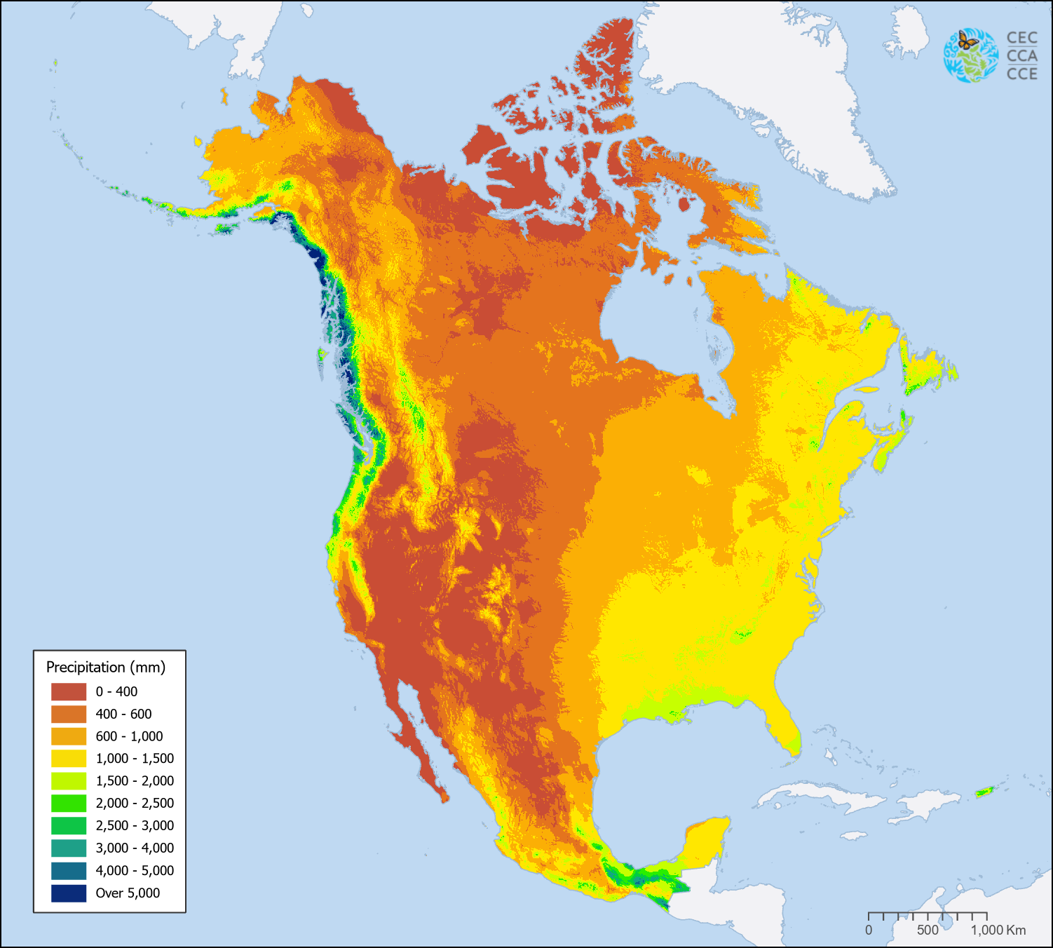
The annual precipitation raster layers available in the North American Environmental Atlas represent key climatological variables, including Total Annual Precipitation, Precipitation of the Wettest Month, and Precipitation of the Driest Month. These datasets are based on climatological normals for the 1981–2010 reference period.
Together, these annual precipitation layers describe both the spatial distribution of precipitation across North America and its seasonal variability throughout the year. They provide detailed information on total annual amounts as well as precipitation extremes during the wettest and driest months. This information supports a wide range of ecological, environmental, and climate-related analyses by offering baseline climatological conditions essential for species distribution modeling, land cover interpretation, climate impact assessments, agricultural and forestry applications, water resource evaluations, and hydrological modeling.
The North America precipitation layers were derived from the CHELSA v2.1 bioclimatic variables and CHELSA-climatologies v2.1 datasets, an assemblage of high-resolution global climate products developed by the Climatologies at High Resolution for the Earth’s Land Surface Areas (CHELSA) initiative hosted at the Swiss Federal Institute for Forest, Snow and Landscape Research WSL.
Contact
Questions about the North American Environmental Atlas? Contact:
Dominique Croteau
Specialist, Geospatial and Environmental Information