Climate
Climate Zones of North America
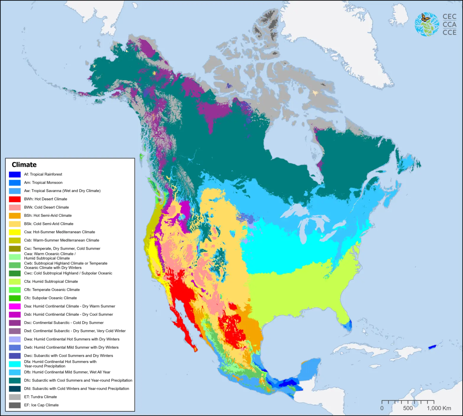
The North American Climate Zones map shows the distribution of climate types across Canada, Mexico, and the United States based on the Köppen-Geiger climate classification.
This map is derived from the global climate zones presented by Beck et al. (2018), “Present and future Köppen-Geiger climate classification maps at 1-km resolution,” and represents the spatial distribution in vector format of 29 climate zones (out of 30 global climate zones) present in North America.
This map was produced by resampling the original input data spatial resolution of 0.0083 degrees to 0.016 degrees and cropping the global data to the North American region. The map was used to meet the needs of the CEC project “Improving the effectiveness of early warning systems for drought” in assessing the effectiveness of available drought indicators and indices in climate zones of North America.
Reference:
Beck, H., Zimmermann, N., McVicar, T. et al. Present and future Köppen-Geiger climate classification maps at 1-km resolution. Sci Data 5, 180214 (2018). https://doi.org/10.1038/sdata.2018.214
Downloadable Files
Contact
Questions about the North American Environmental Atlas? Contact:
Dominique Croteau
Specialist, Geospatial and Environmental Information