MapMonday
It might not always seem like it, but #maps play a big role in the lives we lead today. From tracking Uber orders in Montreal to understanding the effect of coastal farming activity in Sinaloa, Mexico– maps help us navigate and understand the world around us.⠀
⠀
Follow along with us every #MapMonday to learn more about the stories and information maps tell us!

Search
Year
Keywords
#MapMonday
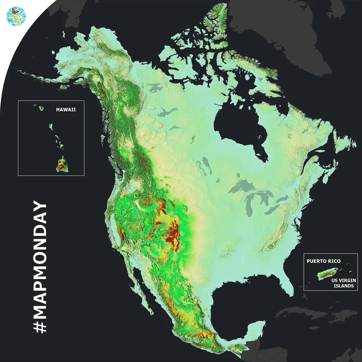
North American Elevation
December, 2023
Ecoregions, Land Cover
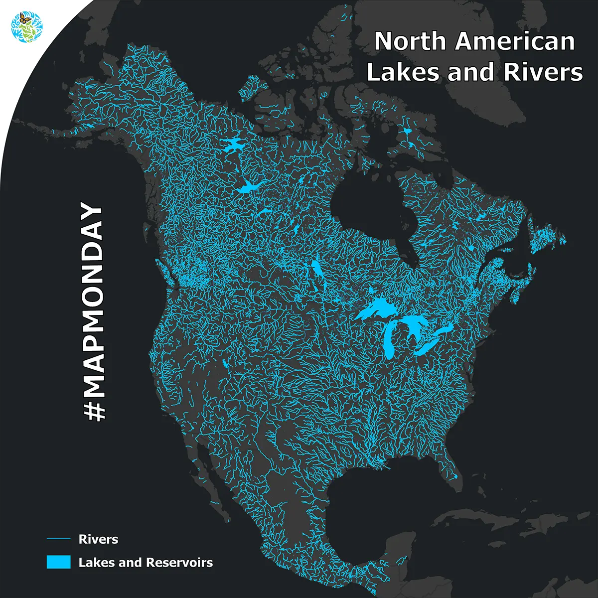
North American Lakes and Rivers
November, 2023
Water
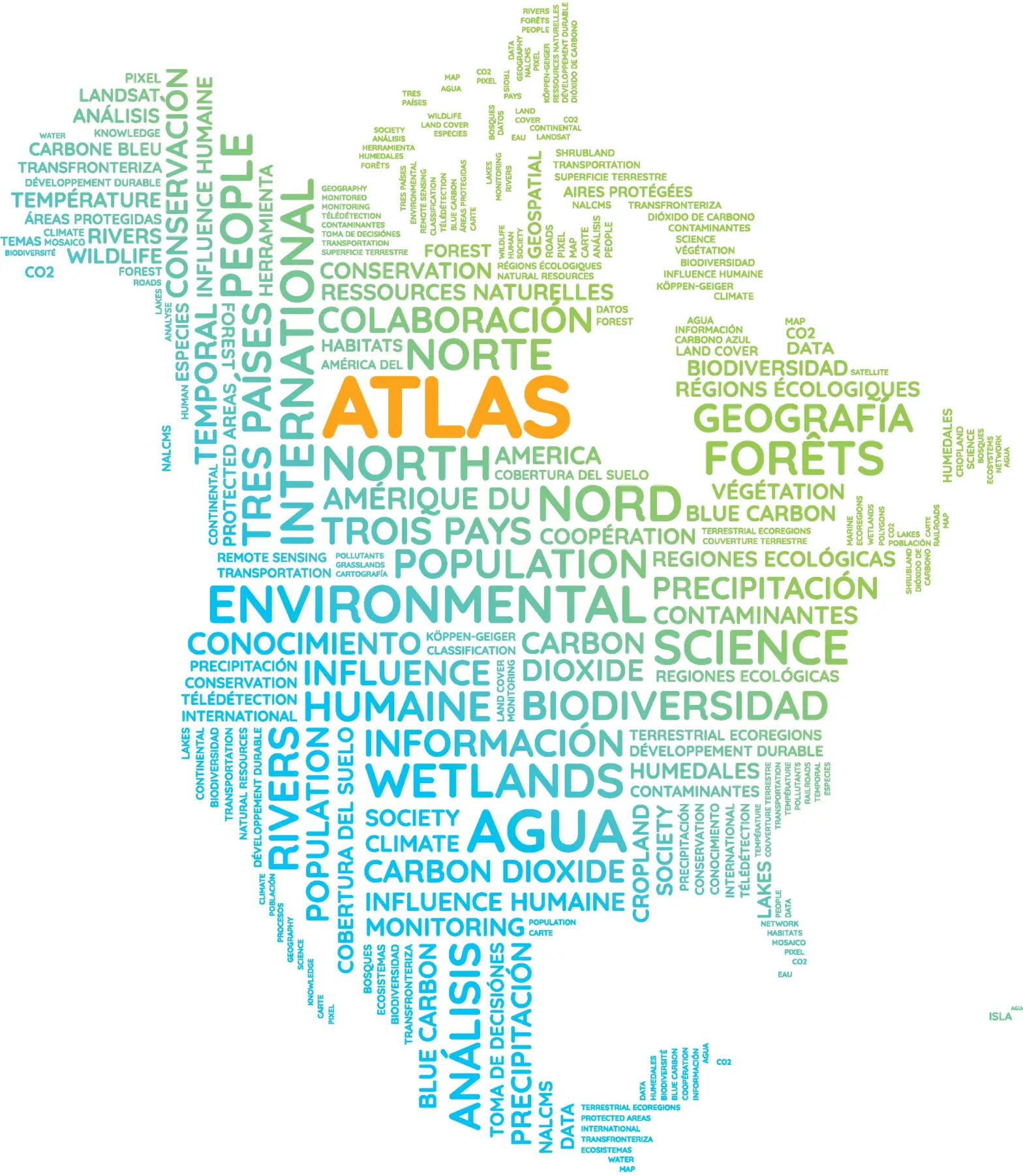
Atlas WordCloud
October, 2023
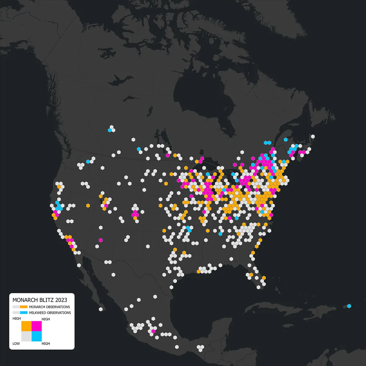
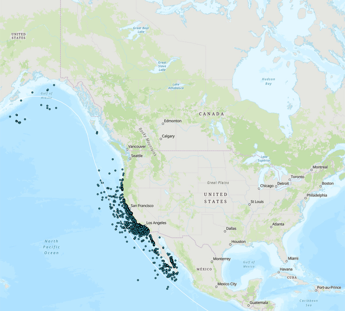
Monarch Monitoring Blitz 2023
September, 2023
Species
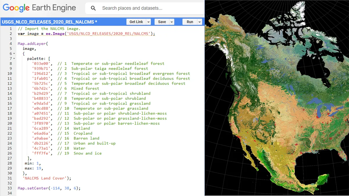
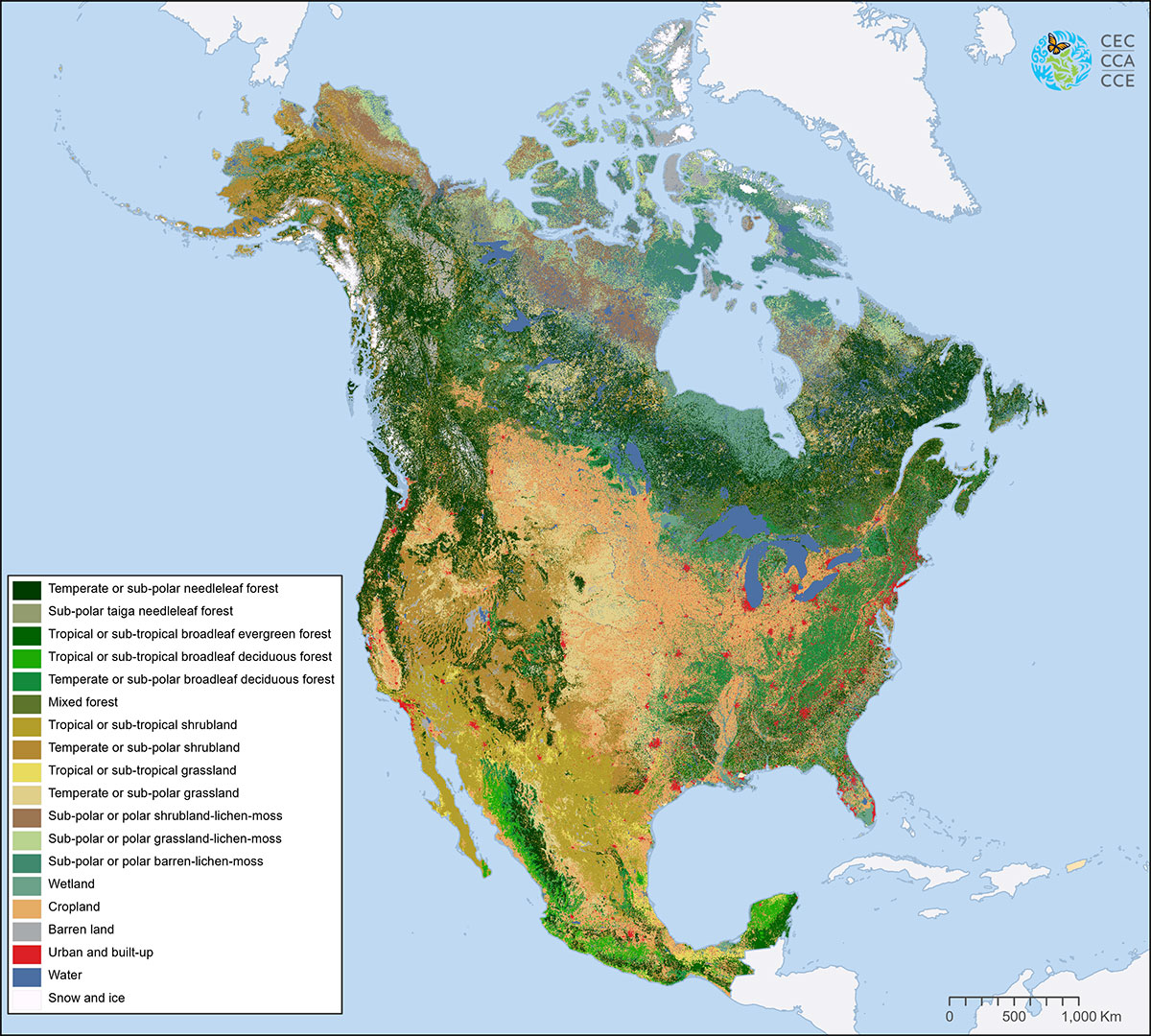
North American Land Cover 2020 on GEE
August, 2023
Land Cover
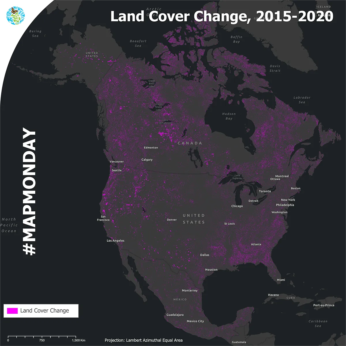
Land cover change, 2015-2020
July, 2023
Land Cover
World Ocean Day
June, 2023
Protected Areas, Water
Your Environment is Changing
May, 2023
Climate, Ecoregions, Humans
Land Cover
April, 2023
Land Cover
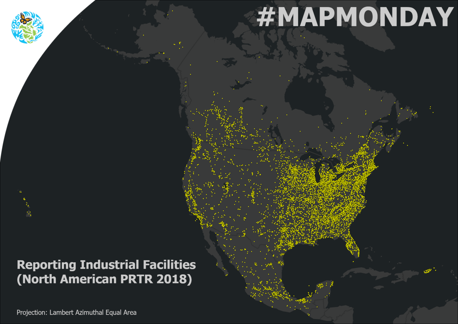
North American Pollutant Release and Transfer Registers
March, 2023
Pollutant Releases and Transfers
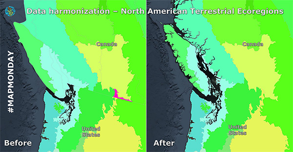
Data Harmonization
February, 2023
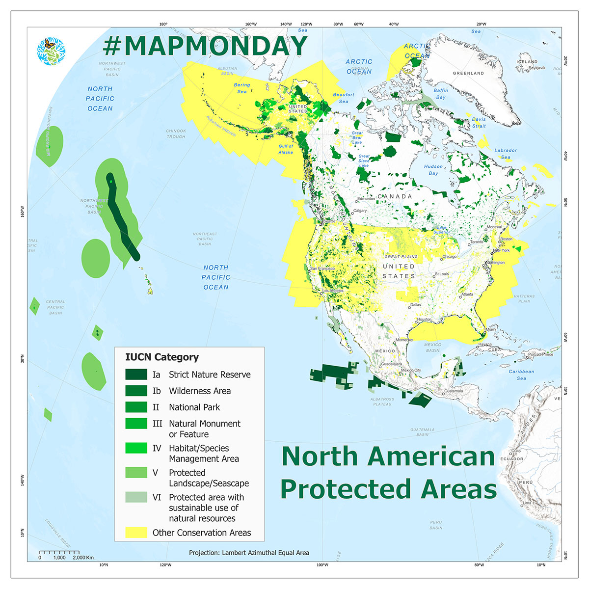
Protected Areas
December, 2022
Protected Areas
Contact Us
Be the first to hear when we publish new GIS data and updates. We promise we won’t send you anything else.
Dominique Croteau
Project Lead, Geospatial and Environmental Information
(514) 350-4307