Working with the community to reduce vulnerability to flooding in the Richelieu River basin
Organization: Nature Conservancy Canada
Location: Henryville, Saint-Georges-de-Clarenceville, Venise-en-Quebec, Saint-Sébastien, Montérégie, Quebec, Canada
Country: Canada
Other Organizations Involved: Four municipalities and a regional county municipality, the Committee for Dialogue and Development of the Richelieu River Basin (Comité de concertation et de valorisation du bassin de la rivière Richelieu—Covabar), the Canadian Wildlife Fund (CWF), and the Nature Conservancy (TNC), an American organization that is partnering with Nature Conservancy Canada.
Background
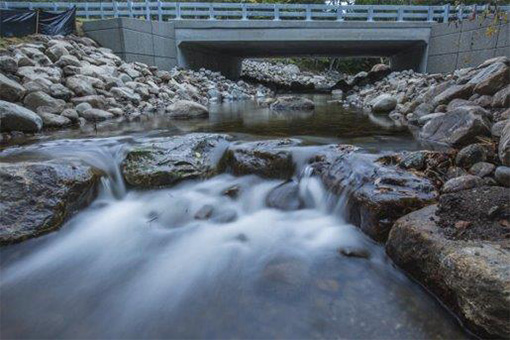
In recent decades, anthropogenic behavior has greatly modified watercourses in Quebec, with grave repercussions on the environment that have increased certain communities' vulnerability to flooding. As recent observations have shown, it is essential to support these communities by building their capacities for adapting to extreme climate events. Scientists foresee an increase in the scope and gravity of such events. Consequently, experts must share their knowledge and prepare the populations residing in high-risk areas, accordingly. Vulnerability to flooding and loss of aquatic connectivity, due to the presence of road and traffic infrastructure which interrupts the water courses, are both crucial issues in terms of climate change adaptation. These issues are particularly important in the Richelieu River and Lake Champlain watersheds, which, in the spring of 2011, experienced the highest ever recorded water levels. This led to flooding in 40 municipalities of the Montérégie region, 11 of which declared local states of emergency. Total damages, assessed in the amount of 82 million dollars, were substantial and included over 3,000 homes flooded. Approximately one hundred roads were cut off and bridges were damaged or destroyed. It is therefore imperative to prepare communities for such events and to encourage changes in the design of water-related infrastructure, including improvements in their capacity to withstand extreme climate events. In Quebec, few tools are currently available to facilitate better planning and policy priorities.
Goals
The principal objectives are to reduce the risks of flooding and to increase aquatic connectivity in the Richelieu River and Lake Champlain watersheds. The project also aims to encourage changes in behavior among stakeholders of land-use planning, particularly in relation to water-related infrastructure. The project will therefore inform the employees of the Montérégie Regional Directorate of Transports Québec, the county regional municipalities, and the municipalities themselves of the implications of obsolete and inadequate water-related infrastructure, particularly in relation to the risks of flooding and the loss of aquatic connectivity. These actors will then be in a position to integrate the tools developed by the project, prioritize the infrastructure or areas to be restored, and review the policies, strategies and guidelines on water-related infrastructure under their respective areas of responsibility.
Main activities
As part of the pilot project, Nature Conservancy of Canada (NCC) and its partners will validate, on the ground, the data generated via the NCC’s mapping of aquatic connectivity in the Brochets River sub-basin. These data will be used to make regional maps which will indicate the priority areas for intervention, such as places where water crossing infrastructure is under-sized, as well as areas where variations in water flow are problematic and require drainage regulation and/or wetlands creation. Armed with these maps, the NCC will hold workshops to transfer knowledge to local stakeholders, permitting them to have optimal utilization of the data collected and ensuring that the participants can assimilate the conclusions acquired from the planning and land-use management tools. In a later phase, the project will put the data collected online to extend its outreach and answer needs in both the southern part of Quebec and the Maritimes.
Results
The project’s objective is to encourage changes in the behavior among land-use planning stakeholders, specifically as regards water-related infrastructure. The project will therefore inform employees of the Montérégie Regional Directorate of Transports Québec, the county regional municipalities, and the municipalities themselves of the implications of obsolete and inadequate water-related infrastructure, particularly as regards the risks of flooding and the loss of aquatic connectivity. These actors will then be in a position to integrate the tools developed by the project, prioritize the infrastructure or areas to be restored, and review the policies, strategies and guidelines on water-related infrastructure under their respective areas of responsibility.