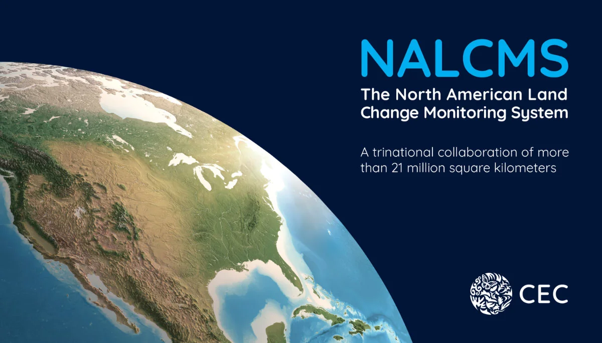
North American Land Change Monitoring System
The CEC’s NALCMS is a collaborative initiative that monitors land cover in North America and its changes over time. Land cover, the classification of surface features such as forests, urban infrastructure, bodies of water or agricultural land, play crucial roles in understanding and managing our environment. By distinguishing natural and human-made features, land cover and land use data support global, regional and local monitoring efforts, resource management and planning activities.
Learn more about the NALCMS initiative in this publication marking nearly 20 years of trinational partnership.
What is NALCMS?

North America
North America
As with all work done at the CEC, the North American Land Change Monitoring System (NALCMS) initiative focuses on Canada, Mexico and the United States.

Geospatial collaboration
Geospatial collaboration
The CEC’s NALCMS is a collaborative initiative with Natural Resources Canada (NRCan)’s Canada Centre for Mapping and Earth Observation (CCMEO), the United States Geological Survey (USGS), and three Mexican agencies: the National Institute of Statistics and Geography (Instituto Nacional de Estadística y Geografía—INEGI), the National Commission for the Knowledge and Use of Biodiversity (Comisión Nacional para el Conocimiento y Uso de la Biodiversidad—Conabio), and the National Forestry Commission (Comisión Nacional Forestal—Conafor).
21 million km2
21 million km2
The North American land cover products represent the surface areas of Canada, Mexico and the United States, resulting in a total surface area of more than 21 million square kilometers, equivalent to more than half of the surface area of the Moon (or more than an entire Full Moon)!

19 land cover classes
19 land cover classes
NALCMS harmonizes geospatial data into 19 comparable classes across Canada, Mexico and the United States. The NALCMS land cover classes are based on the Land Cover Classification System (LCCS) standard developed by the Food and Agriculture Organization (FAO) of the United Nations.

Data harmonization
Data harmonization
“Data harmonization” is essentially a process of combining and adapting data from different sources, making it usable for analysis and decision-making. In the case of the NALCMS land cover products, this allows a seamless view of our shared North American environment.
23 billion pixels
23 billion pixels
Derived from Landsat satellite imagery at a 30-meter spatial resolution, the North American land cover product is composed of more than 23 billion pixels. In photographic terms, that would represent a 23,000 Megapixel (MP) photo image, or more than 2,700 times the number of pixels in a 4K Ultra High Definition (UHD) image.

Transboundary data
Transboundary data
When analyzing land cover at the North American level, the NALCMS harmonized data can help provide a continental perspective on transboundary environmental issues.

Research & Decision-making
Research & Decision-making
The North American land cover products support policy- and decision-makers, researchers, international and intergovernmental organizations, NGOs, land managers, among many others, from local to global interests, by allowing them to conduct both regional and local-level analyses and better understand the dynamics and patterns of North America’s land cover.

Knowledge-sharing
Knowledge-sharing
Over the years, the NALCMS members have benefited from each other’s expertise when working on national and regional initiatives. This long-standing collaboration and knowledge-sharing have helped strengthen the creation of land cover datasets and maps in all three countries, and in North America as a whole.

+500 scientific publications
+500 scientific publications
More than 500 research articles, tools, and presentations, showcasing the use of NALCMS products, have been developed and published in North America and internationally.
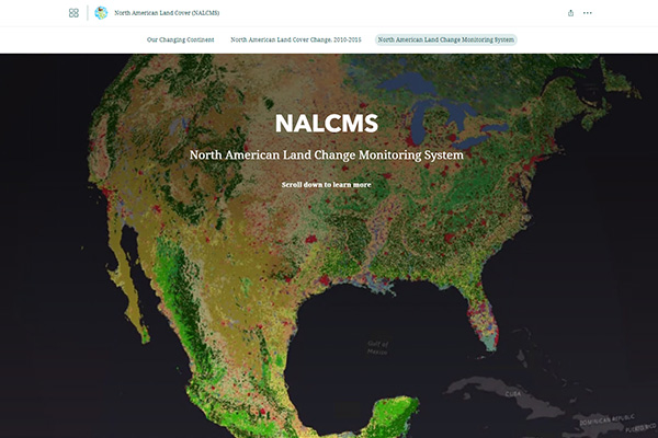
Map Files
All NALCMS land cover products are available in the North American Environmental Atlas
Since its launch in 2006, NALCMS has made its land cover products publicly available through the CEC’s North American Environmental Atlas, a collection of harmonized geospatial data from Canada, Mexico and the United States. These thematic map layers provide a continental perspective on transboundary environmental issues and allow the visualization of such environmental aspects as terrestrial and marine ecological regions, climatic zones, and protected areas of the three countries.
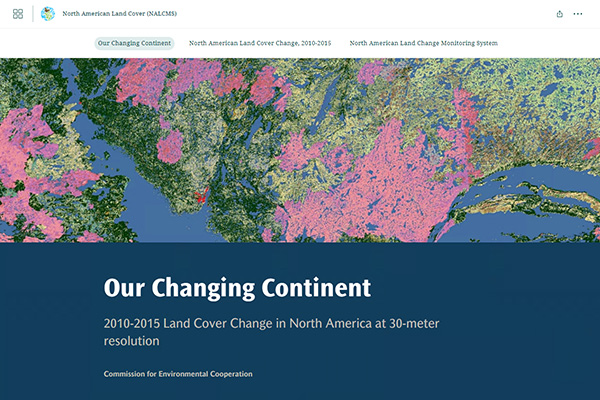
Story Maps
Partner Organisations
The CEC’s NALCMS is a collaborative initiative with Natural Resources Canada (NRCan)’s Canada Centre for Mapping and Earth Observation (CCMEO), the United States Geological Survey (USGS), and three Mexican agencies: the National Institute of Statistics and Geography (Instituto Nacional de Estadística y Geografía—INEGI), the National Commission for the Knowledge and Use of Biodiversity (Comisión Nacional para el Conocimiento y Uso de la Biodiversidad—Conabio), and the National Forestry Commission (Comisión Nacional Forestal—Conafor).


Publications
Contact
Questions about the NALCMS? Contact:
Dominique Croteau
Specialist, Geospatial and Environmental Information