Wetlands
Map type: Terrestrial Ecosystems
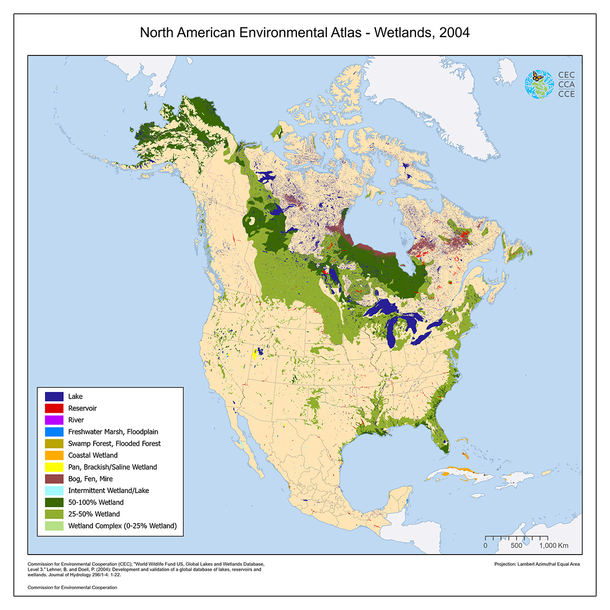
This map shows different wetland types, as well as lakes and rivers, across North America.
The map was made using the Global Lakes and Wetlands Database (GLWD), which was created using a variety of the best available sources for lakes and wetlands on a global scale.
Source: Lehner, B., and P. Döll. 2004. Development and validation of a global database of lakes, reservoirs and wetlands. Journal of Hydrology 296/1-4: 1–22. Global Lakes and Wetlands Database available through World Wildlife Fund (WWF).
Contact
Questions about the North American Environmental Atlas? Contact:
Dominique Croteau
Project Lead, Geospatial and Environmental Information