Terrestrial Ecoregions: Level III
Map type: Terrestrial Ecosystems
Ecological regions are areas of general similarity in ecosystems and in the type, quality, and quantity of environmental resources.
They serve as a spatial framework for the research, assessment, management, and monitoring of ecosystems and ecosystem components.
They are effective for national and regional state of the environment reports, environmental resource inventories and assessments, setting regional resource management goals, determining carrying capacity, as well as developing biological criteria and water quality standards.
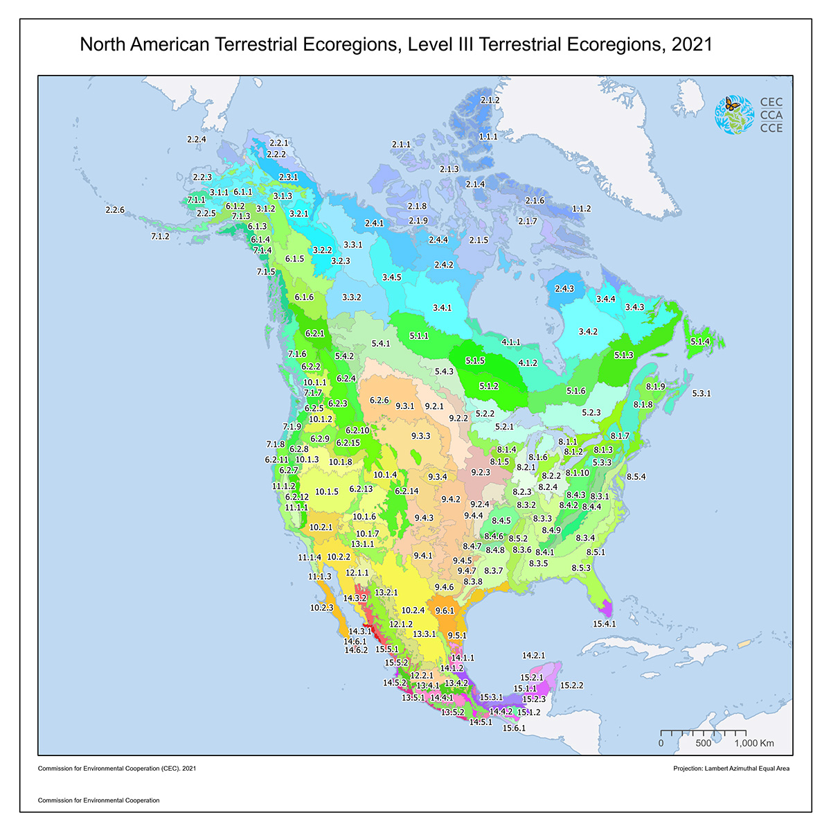
A Roman numeral hierarchical scheme has been adopted for different levels of ecological regions.
Level I is the coarsest level, dividing North America into 15 broad ecological regions.
These highlight major ecological areas and provide the broad backdrop to the ecological mosaic of the continent, putting it in context at global or intercontinental scales.
Brief narrative descriptions of each level I region can be found in the CEC publication Ecological Regions of North America--Toward a Common Perspective.
The 50 level II North American ecological regions provide a more detailed description of the large ecological areas nested within the level I regions and are useful for national and sub-continental overviews of ecological patterns.
The 182 level III ecological regions, smaller ecological areas nested within level II regions, enhance regional environmental monitoring, assessment and reporting, as well as decision-making.
Contact
Questions about the North American Environmental Atlas? Contact:
Dominique Croteau
Project Lead, Geospatial and Environmental Information