North American Forests, 2022
Map type: Terrestrial Ecosystems
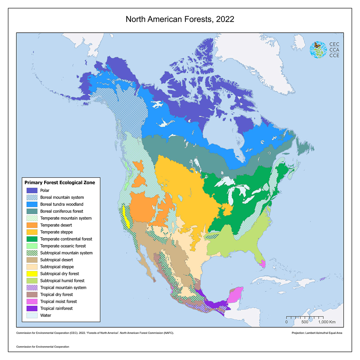
The North American Forest map shows the distribution of eighteen different primary ecological zones pertaining to forest systems within Canada, Mexico, and the United States.
North American Forest regions are defined as areas of broad yet relatively homogenous natural forest vegetation. Area distinctions are also based on precipitation, temperature, and landforms.
This map was created based on FAO ecological zones and the updated version of the CEC Terrestrial Ecological Regions of North America (published in 2021). Codes for Terrestrial Ecoregions were converted to the FAO Ecological Zones classes, based on the “Global Ecological Zones for FAO Forest Reporting: 2010 Update” (equivalencies between Ecological Zones and Terrestrial Ecoregions were defined through deliberation among experts from Canada, Mexico, and the United States of America).
The FAO ecological zones are based on a combination of climate (temperature and precipitation) and potential vegetation classifications. They are broad areas of relatively homogeneous vegetation, with similar physical characteristics. Some ecological zones (e.g., temperate steppe) contain limited or no forest; areas are considered forested when they have a 10 percent minimum crown cover. Orchards and other fruit tree plantations used for agricultural production are not classified as forests.
The current update responds to the recent changes in the geometry of the Terrestrial Ecoregions of North America published by CEC in 2021.
Contact
Questions about the North American Environmental Atlas? Contact:
Dominique Croteau
Project Lead, Geospatial and Environmental Information