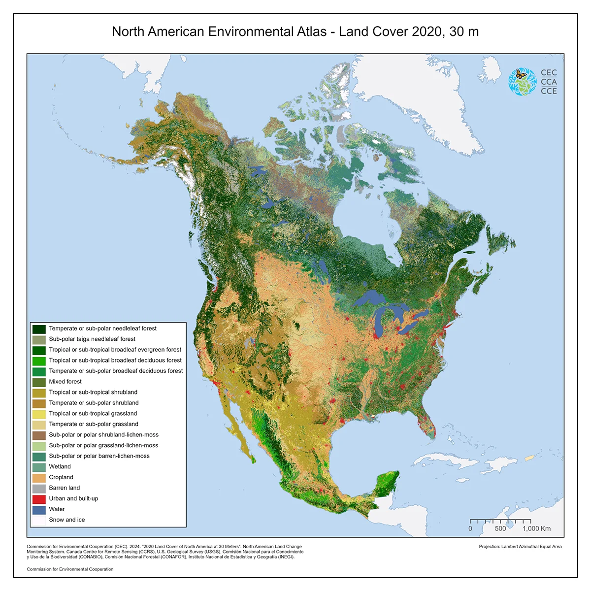
North American Land Cover, 2020 (Landsat, 30m)
Map type: Terrestrial Ecosystems
This map of North American land cover provides a harmonized view of the physical cover of Earth’s surface across the continent at a spatial resolution of 30 meters, based on Landsat satellite imagery for Canada, Mexico, and the United States.
Land Cover classes can include natural features such as tropical forest, shrubland, grassland, water bodies, and bare land, but also human-made features such as asphalt cover and cropland. Nineteen land cover classes were defined, using the Land Cover Classification System (LCCS) standard developed by the Food and Agriculture Organization (FAO) of the United Nations.
This map was produced through the CEC’s North American Land Change Monitoring System (NALCMS), a collaborative initiative with Natural Resources Canada (NRCan)’s Canada Centre for Mapping and Earth Observation (CCMEO), the United States Geological Survey (USGS), and three Mexican organizations: the National Institute of Statistics and Geography (Instituto Nacional de Estadística y Geografía—INEGI), the National Commission for the Knowledge and Use of Biodiversity (Comisión Nacional para el Conocimiento y Uso de la Biodiversidad—Conabio), and the National Forestry Commission (Comisión Nacional Forestal—Conafor).
Contact
Questions about the North American Environmental Atlas? Contact:
Dominique Croteau
Project Lead, Geospatial and Environmental Information