Terrestrial Ecosystems
Land Cover, 2010 (Landsat, 30m)
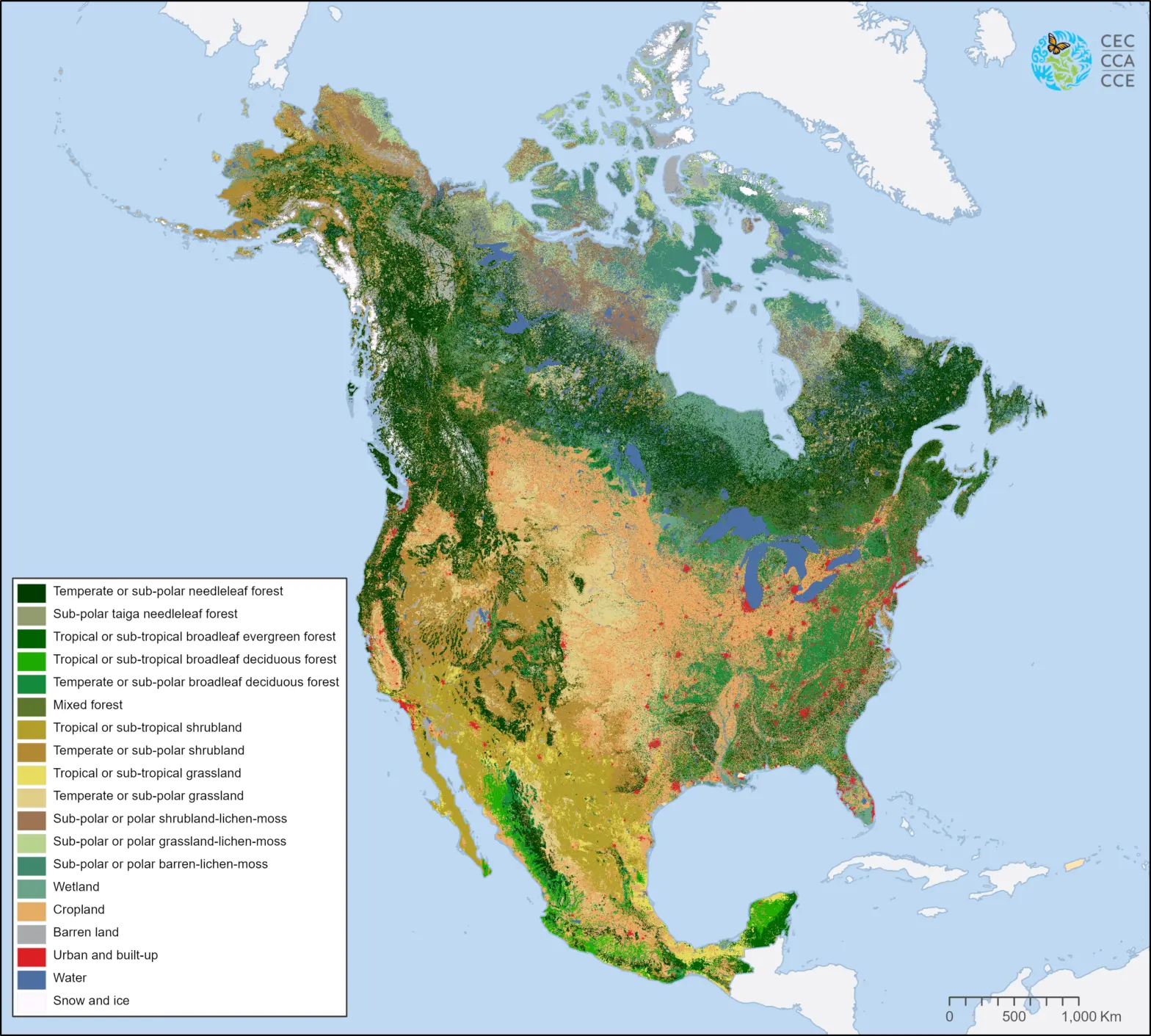
This map of North American land cover at a spatial resolution of 30 meters provides a harmonized view of the physical cover of Earth's surface across the continent based on 2010 Landsat satellite imagery.
Nineteen Level II land cover classes were defined using the Land Cover Classification System (LCCS) standard developed by the Food and Agriculture Organization (FAO) of United Nations.
This map replaces Edition 1.0 of the 2010 Land Cover of North America published in November 2017. The current Edition 2.0 includes updates to land cover classifications across Canada and the United States, while Mexico’s land cover information remains identical to Edition 1.0. Access to Edition 1 of the 2010 map can be provided upon request.
The North American Land Change Monitoring System (NALCMS) is a collaborative initiative between Natural Resources Canada/Canada Centre for Remote Sensing (NRCan/CCRS); the United States Geological Survey (USGS); and three Mexican organizations: Insituto Nacional de Estadística y Geografía (INEGI); Comisión Nacional para el Conocimiento y Uso de la Biodiversidad (CONABIO); and Comisión Nacional Forestal (CONAFOR). The project is facilitated by the Commission for Environmental Cooperation (CEC).
Partner Organisations


Contact
Questions about the North American Environmental Atlas? Contact:
Dominique Croteau
Specialist, Geospatial and Environmental Information