Terrestrial Ecosystems
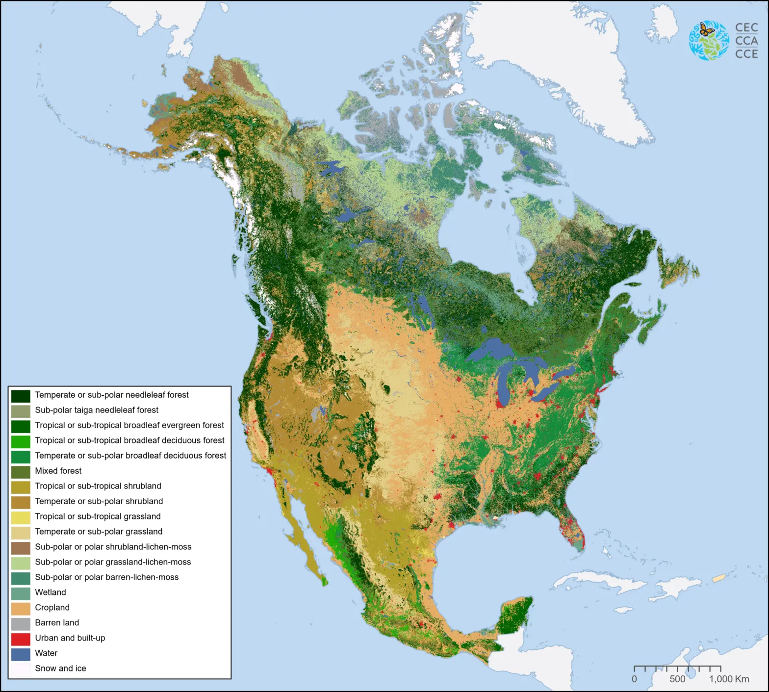
Land Cover, 2005 (MODIS, 250m)
This map of North American land cover at a spatial resolution of 250 meters provides a harmonized view of the physical cover of Earth's surface across the continent based on 2005 Moderate Resolution Imaging Spectroradiometer (MODIS) satellite imagery.
Nineteen Level II land cover classes were defined using the Land Cover Classification System (LCCS) standard developed by the Food and Agriculture Organization (FAO) of United Nations.
The North American Land Change Monitoring System (NALCMS) is a collaborative initiative between Natural Resources Canada/ Canada Centre for Mapping and Earth Observation (NRCan/CCMEO); the United States Geological Survey (USGS); and three Mexican organizations: Insituto Nacional de Estadística y Geografía - INEGI; Comisión Nacional para el Conocimiento y Uso de la Biodiversidad - CONABIO); and Comisión Nacional Forestal - CONAFOR. The project is facilitated by the Commission for Environmental Cooperation (CEC).
This data set replaces Edition 1.0 of the 2005 Land Cover of North America published in March 2010. Following the release of the first 2005 land cover data, several errors were identified in the data and rectified, including both errors in labeling and misinterpretation of thematic classes. Access to the initial Land Cover 2005 map can be provided upon request.
Partner Organisations


Contact
Questions about the North American Environmental Atlas? Contact:
Dominique Croteau
Specialist, Geospatial and Environmental Information