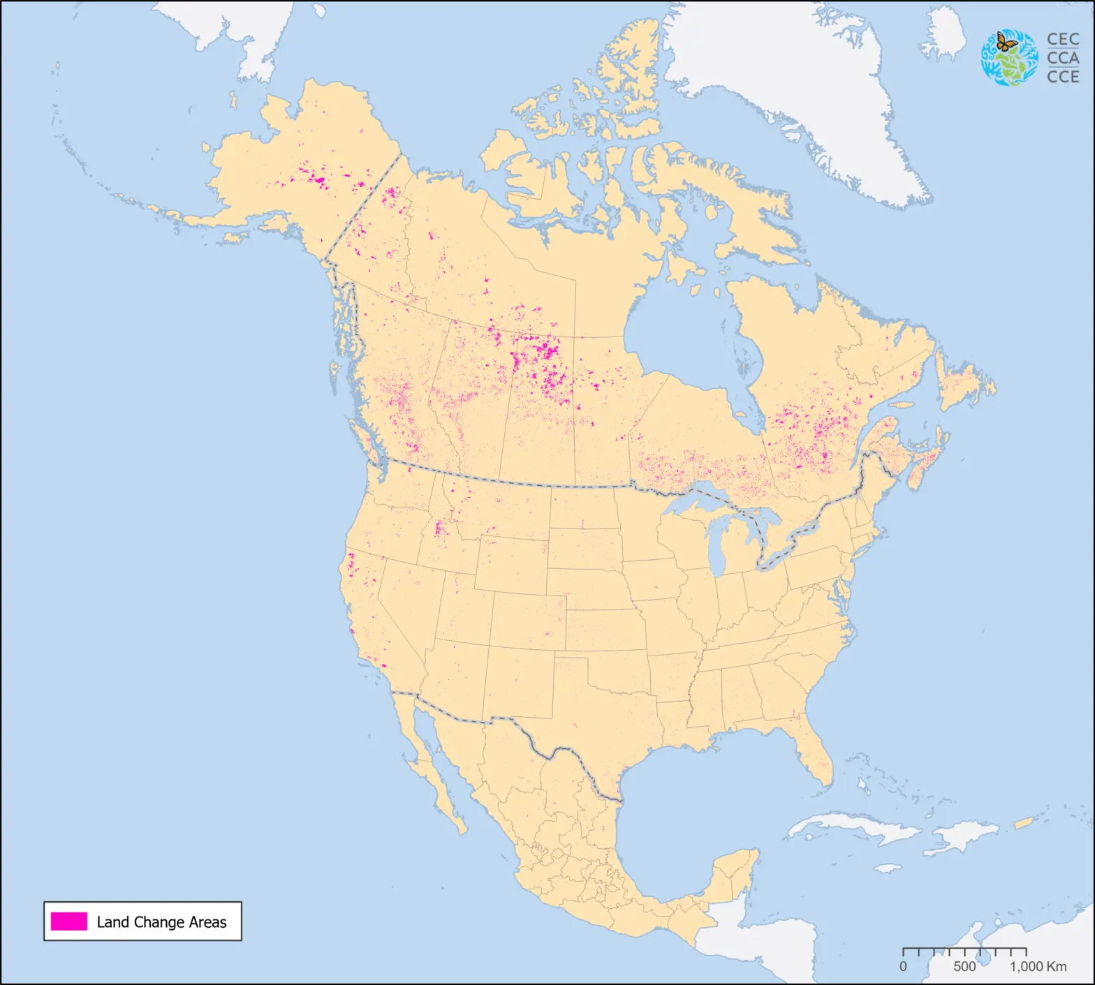
Land Cover Change, 2005-2010 (MODIS, 250m)
Map type: Terrestrial Ecosystems
This map demonstrates land cover change between 2005 and 2010 in North America at a spatial resolution of 250 meters.
The dataset shows the 2005-2010 changes between the nineteen Level II land cover classes, which were defined using the Land Cover Classification System (LCCS) standard developed by the Food and Agriculture Organization (FAO) of United Nations.
The land cover change data is part of a series of maps produced by the North American Land Change Monitoring System (NALCMS). NALCMS is a collaborative initiative between Canada, Mexico, and the United States to monitor land cover and its change over time. The NALCMS product displayed in this map represents land cover change based on monthly composites of 2005 and 2010 Moderate Resolution Imaging Spectroradiometer (MODIS) satellite imagery. The NALCMS is a joint project between Natural Resources Canada/Canada Centre for Remote Sensing (NRCan/CCRS); the United States Geological Survey (USGS); and three Mexican organizations: Insituto Nacional de Estadística y Geografía - INEGI; Comisión Nacional para el Conocimiento y Uso de la Biodiversidad - CONABIO); and Comisión Nacional Forestal - CONAFOR. The project is facilitated by the Commission for Environmental Cooperation (CEC).
Partner Organisations


Contact
Questions about the North American Environmental Atlas? Contact:
Dominique Croteau
Specialist, Geospatial and Environmental Information