Elevation, 2023
Map type: Reference
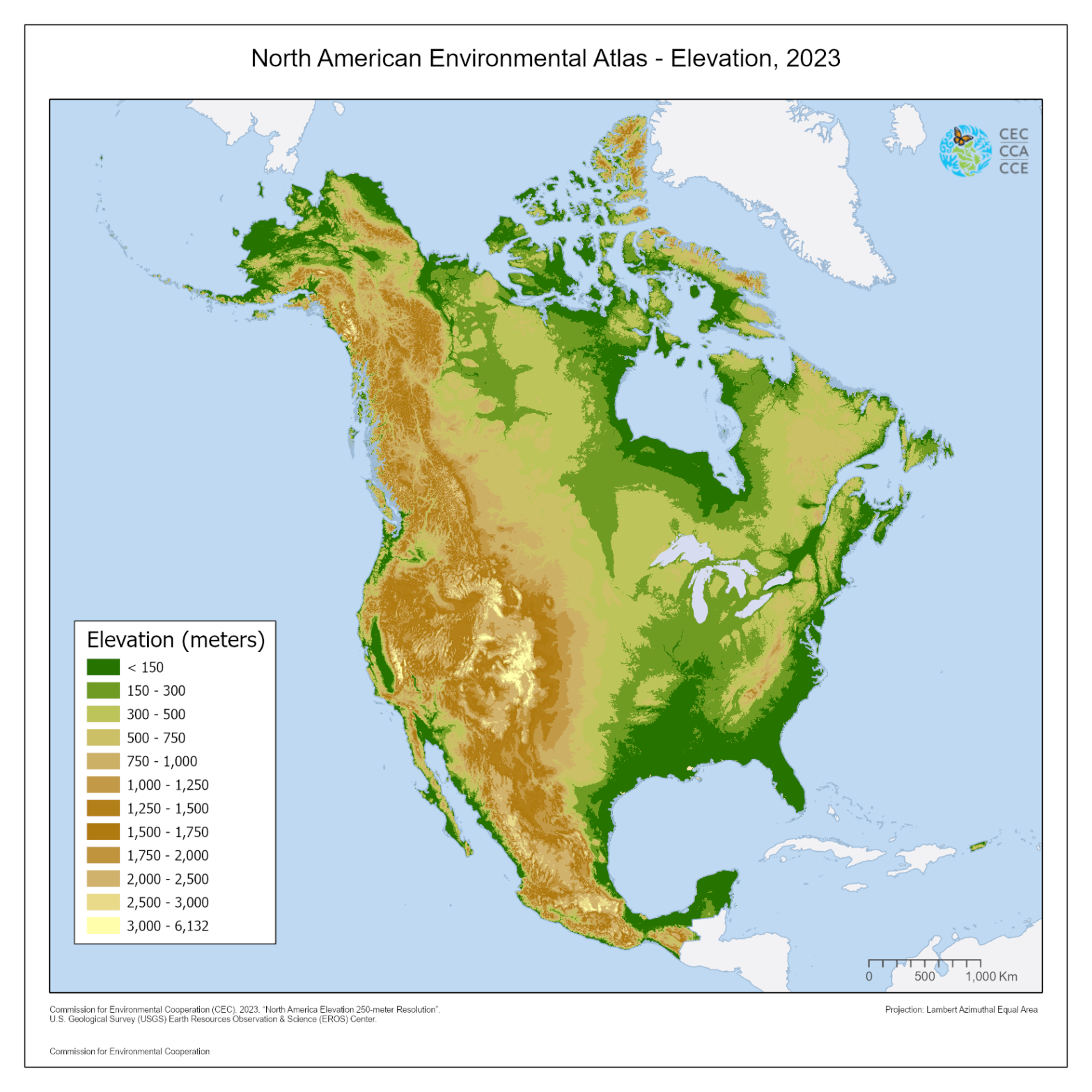
The 250m elevation map of North America illustrates the region's terrain in relation to mean sea level, utilizing elevation data sourced from the Global Multi-resolution Terrain Elevation Data 2010 (GMTED2010).
This dataset supersedes its predecessor, the 1-km elevation dataset released by the Commission for Environmental Cooperation (CEC) in 2007, offering heightened topographic detail while maintaining a manageable file size at the North American level.
The topographic features depicted in this map serve as valuable input data for diverse applications, including topographic mapping, hydrological modeling, and the management of natural resources such as forestry and agriculture. They can also facilitate three-dimensional visualization of the landscape and contribute to landforms analysis.
Contact
Questions about the North American Environmental Atlas? Contact:
Dominique Croteau
Project Lead, Geospatial and Environmental Information