Commercial Marine Vessel Emissions
Map type: Pollution and Waste
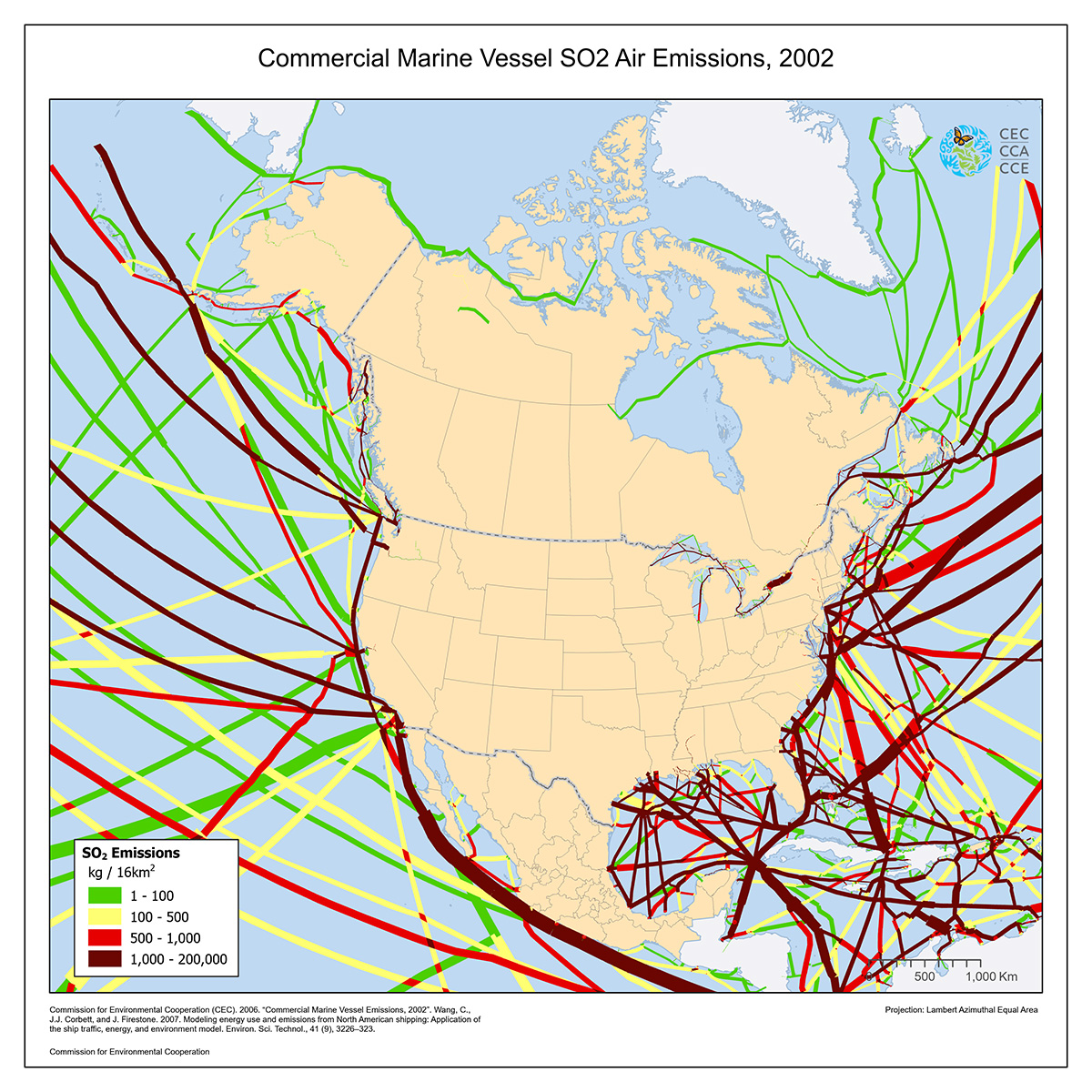
This map illustrates the estimated air emissions of sulfur (SOX as SO2) from cargo traffic in shipping lanes serving North American coastlines in the year 2002.
SO2 emissions were estimated using a model called the Waterway Network Ship Traffic, Energy and Environment Model (STEEM), which characterizes ship traffic, estimates energy use, and assesses the environmental impacts of shipping.
Annual gridded inventories are also available for nitrogen, carbon dioxide, particulate matter, hydrocarbons and carbon monoxide.
Source: Wang, C., J.J. Corbett, and J. Firestone. 2007. Modeling energy use and emissions from North American shipping: Application of the ship traffic, energy, and environment model. Environ. Sci. Technol., 41 (9), 3226–323.
Contact
Questions about the North American Environmental Atlas? Contact:
Dominique Croteau
Project Lead, Geospatial and Environmental Information