CEC Releases Land Cover Map of North America – Highest Quality Available
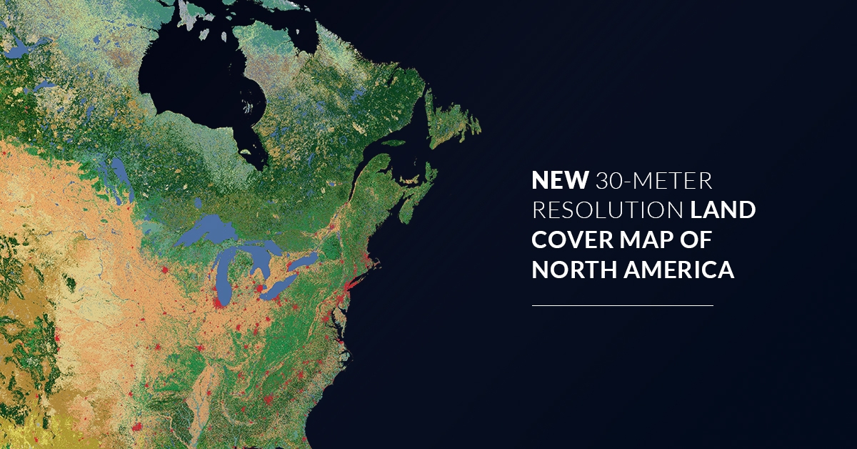
Montreal, 20 February 2020—The North American Land Change Monitoring System (NALCMS), a trinational initiative coordinated by the Commission for Environmental Cooperation (CEC), has released a new map depicting land cover across North America for the year 2015 at a 30-metre spatial resolution. To view and download the map at no cost, click here.
The 2015 publication is the highest quality land cover product for North America to date, boasting improved accuracy in land cover classification over the previous 2010 product.
Created from a composite of images assembled from satellite observations (Landsat and RapidEye), this product is the result of a collaborative effort that harmonized land cover classification systems from Canada, Mexico and the United States into 19 classes, providing a seamless view of the continent at a consistent scale.
This dataset offers invaluable support to international organizations, nongovernmental conservation organizations, land managers, scientific researchers and others by allowing them to better understand the dynamics and continental-scale patterns of North America’s land cover and to conduct both regional and local-level analyses.
North American Land Change Monitoring System
NALCMS is a joint initiative among Natural Resources Canada (NRCan)’s Canada Centre for Mapping and Earth Observation (CCMEO), the United States Geological Survey (USGS), and three Mexican organizations: the National Institute of Statistics and Geography (Instituto Nacional de Estadística y Geografía—INEGI), the National Commission for the Knowledge and Use of Biodiversity (Comisión Nacional para el Conocimiento y Uso de la Biodiversidad—Conabio), and the National Forestry Commission (Comisión Nacional Forestal—Conafor), and supported by the Commission for Environmental Cooperation (CEC). https://www.cec.org/nalcms.
The North American Environmental Atlas
The NALCMS is part of the CEC’s North American Environmental Atlas, bringing together maps, data and interactive map layers to allow for continental and regional perspective on environmental issues that cross boundaries.
About the CEC
The Commission for Environmental Cooperation (CEC) was established in 1994 by the governments of Canada, Mexico and the United States through the North American Agreement on Environmental Cooperation, a parallel environmental agreement to NAFTA. As of 2020, the CEC is recognized and maintained by the Environmental Cooperation Agreement, in parallel with the new Free Trade Agreement of North America. The CEC brings together a wide range of stakeholders, including the general public, Indigenous people, youth, nongovernmental organizations, academia, and the business sector, to seek solutions to protect North America’s shared environment while supporting sustainable development for the benefit of present and future generations
The CEC is governed and funded equally by the Government of Canada through Environment and Climate Change Canada, the Government of the United States of Mexico through the Secretaría de Medio Ambiente y Recursos Naturales, and the Government of the United States of America through the Environmental Protection Agency.