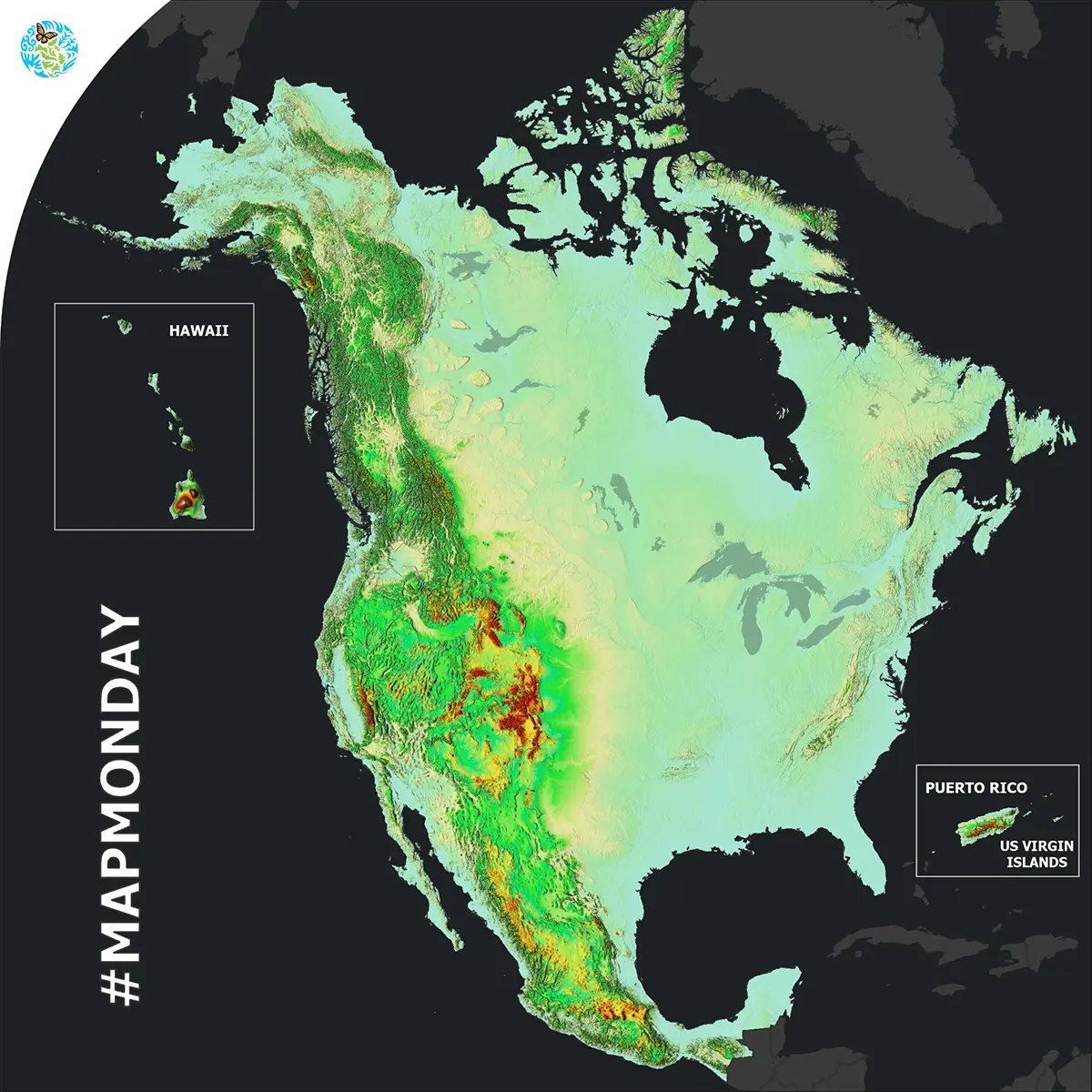
North American Elevation
It’s MapMonday! Did you know that a 2D elevation map can allow you to better understand the 3D reality of our environment by showing the height of the land above sea level?
The new North American Elevation map has a finer resolution of 250m with a manageable file size for this region.
Derived from the Global Multi-resolution Terrain Elevation Data (GMTED2010), this new map layer provides information about the topographic characteristics of North America.
Here are some examples of how it can be used:
- Topographic mapping
- Hydrological modeling and defining watersheds
- Natural resources management (forestry, agriculture, etc.)
- Three-dimensional visualization of the landscape
- Landforms analysis