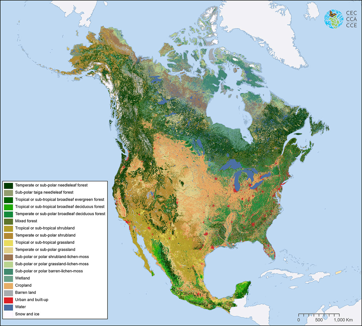
Land Cover
It’s #MapMonday! With about 24 billion pixels depicting land cover across North America at a 30-meter spatial resolution, the North American Land Change Monitoring System (NALCMS) 2020 land cover map layer is the most accurate map available for its scale.
Check out the 2020 North American land cover map layer. This map layer harmonizes land cover classification systems from Canada, Mexico and the United States into 19 comparable classes.
The product provides researchers and interested individuals with high quality information of, for example, forest areas, urban infrastructure, bodies of water, and agricultural land. All publicly available via the Commission for Environmental Cooperation’s North American Environmental Atlas thanks to a trilateral cooperation among specialists across the continent.