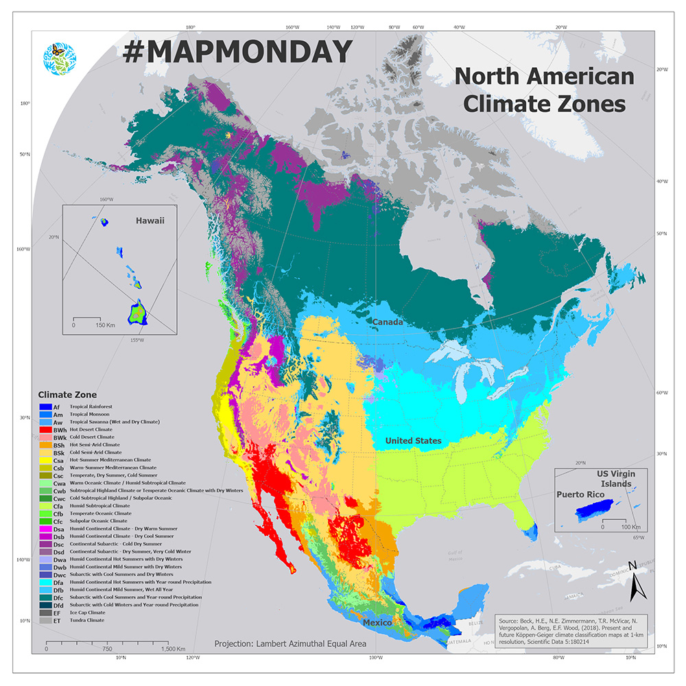
Climate zones in North America
This map shows the diverse climate zones in North America, based on the Köppen-Geiger climate classification system.
Each group and zone is represented by a combination of letters. The main climate groups are tropical (A), dry (B), temperate (C), continental (D) and polar (E). Sub-types are defined using additional letters which further describe temperature and precipitation characteristics such as seasonality and extremes.
Along with our partners from Canada, Mexico and the United States, the Commission for Environmental Cooperation conducted a study aimed at improving the ability of regional and local decision-makers and communities to monitor and prepare for drought conditions through the development of a Guide to locally relevant indicators for North American climate regions.
Soil moisture was notable as the only indicator considered to be very effective in every North American climate zone. Two other indicators—crop status and reservoir storage—were each found to be very effective for most climate zones
The results of this study are summarized in a Guide to Drought Indices and Indicators Used in North America, available online in the CEC’s virtual library.
You can also explore the summary statistics online at National Center for Environmental Information (NCEI) website.