
MapMonday
It might not always seem like it, but #maps play a big role in the lives we lead today. From tracking Uber orders in Montreal to understanding the effect of coastal farming activity in Sinaloa, Mexico– maps help us navigate and understand the world around us.⠀
⠀
Follow along with us every #MapMonday to learn more about the stories and information maps tell us!

Search
Year
Keywords
#MapMonday
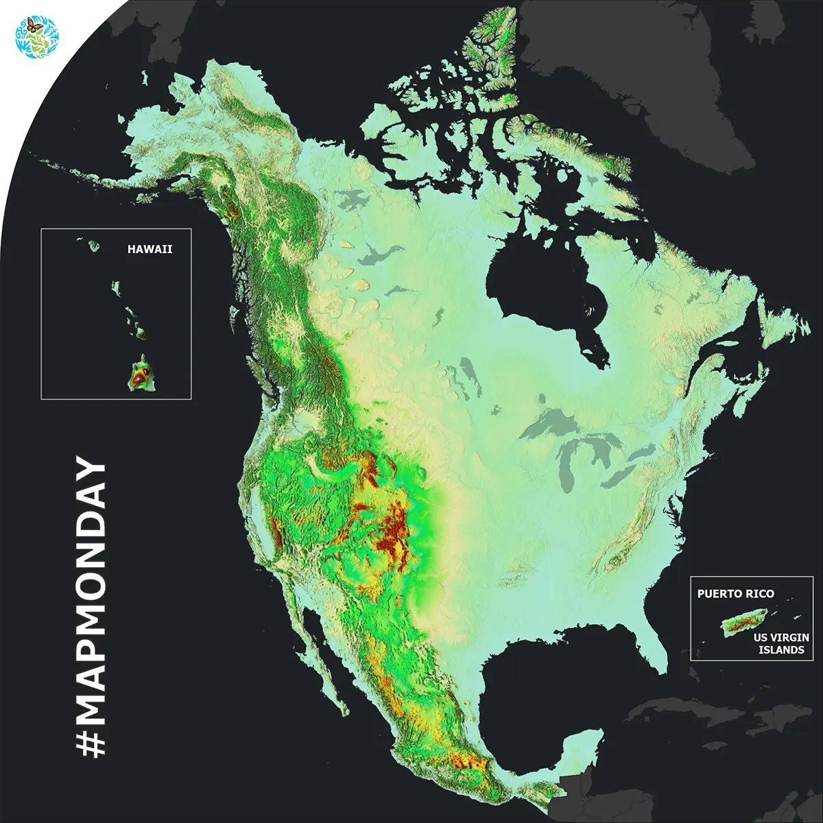
North American Elevation
December, 2023
Ecoregions, Land Cover
It’s MapMonday! Did you know that a 2D elevation map can allow you to better understand the 3D reality of our environment by showing the height of the land above sea level?
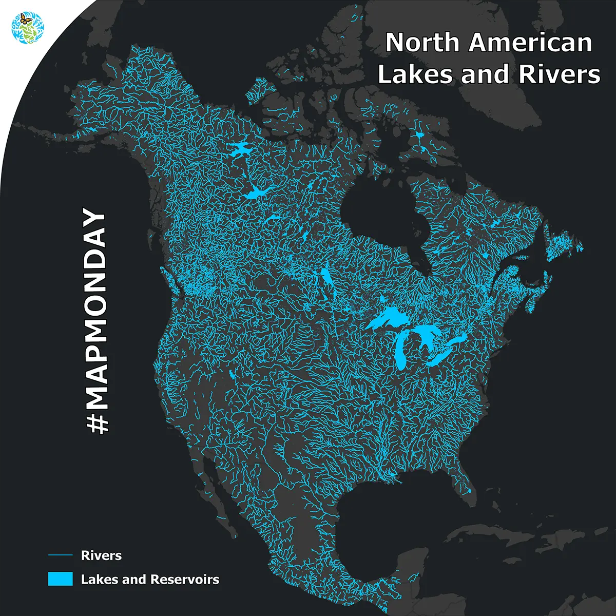
North American Lakes and Rivers
November, 2023
Water
It’s MapMonday! What do the Athabasca River in Canada, the Mississippi River in the United States and Lake Chapala in Mexico have in common?
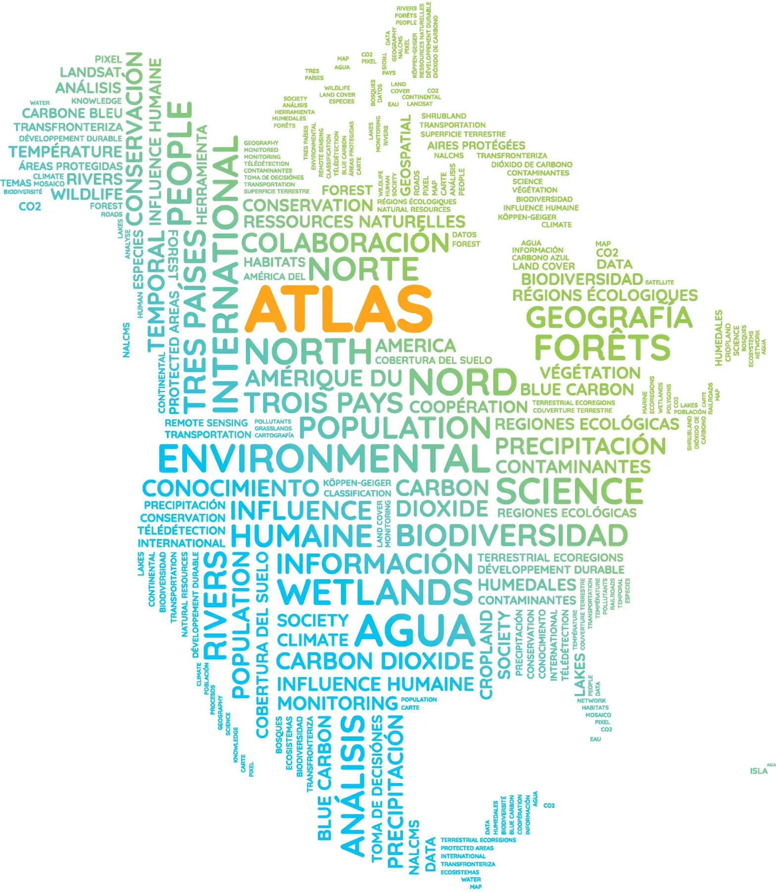
Atlas WordCloud
October, 2023
This #MapMonday, dive into the North American Environmental Atlas, a collection of harmonized geospatial data from #Canada, #Mexico and the #UnitedStates.
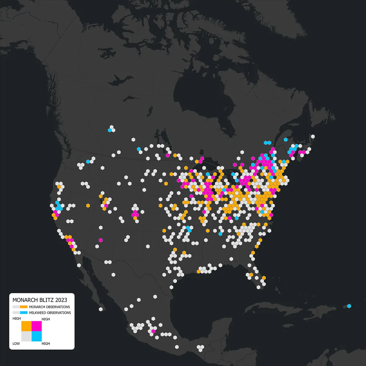
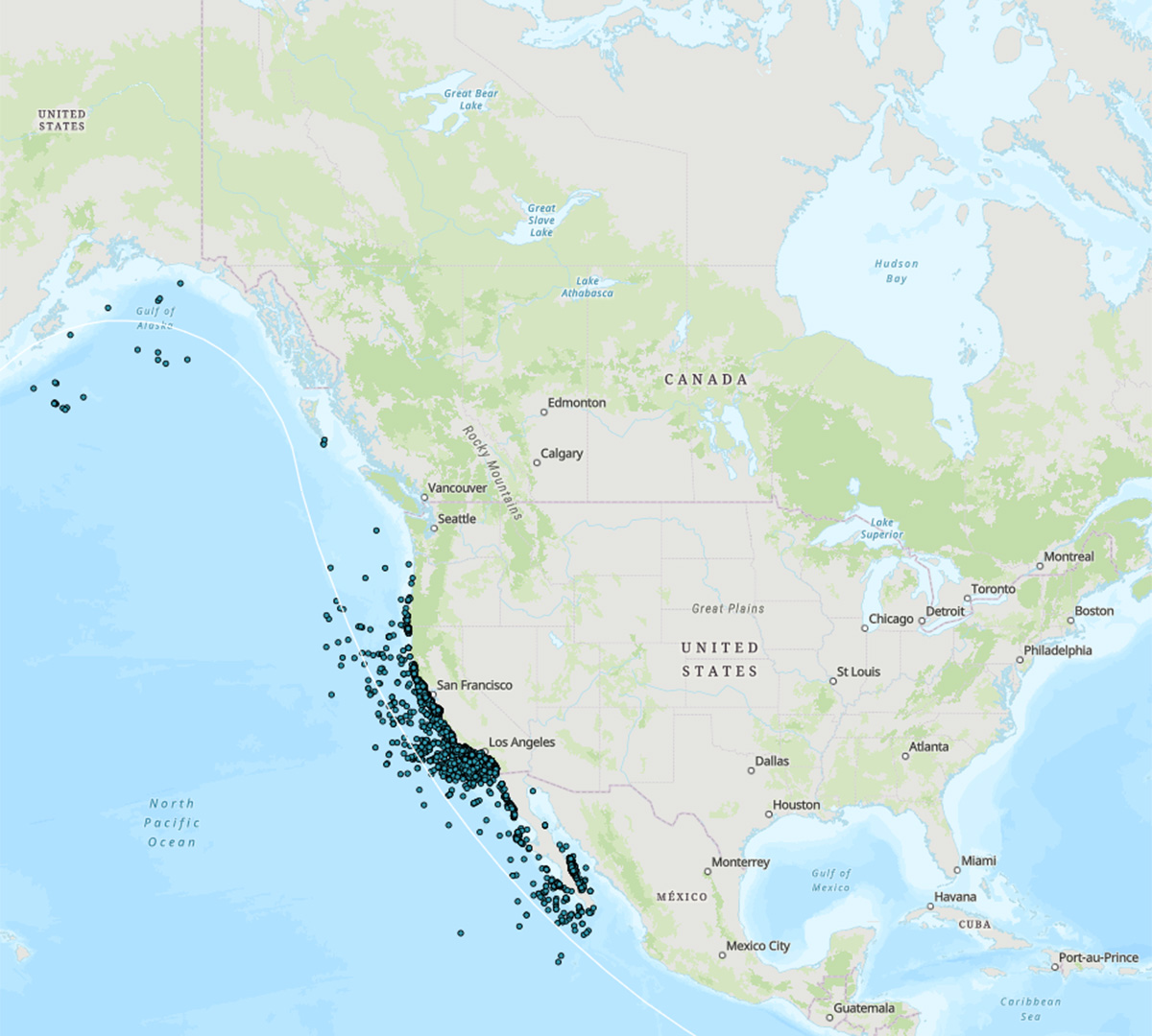
Monarch Monitoring Blitz 2023
September, 2023
Species
It’s #MapMonday! Did you see a monarch butterfly recently?
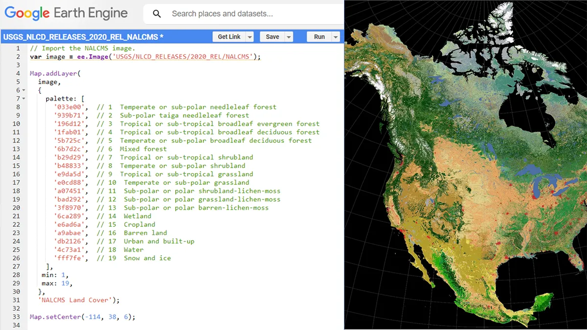
North American Land Cover 2020 on GEE
August, 2023
Land Cover
It’s #MapMonday! #DYK that the Commission for Environmental Cooperation’s new North American Land Cover 2020 is now available on the Google Earth Engine (GEE) platform?
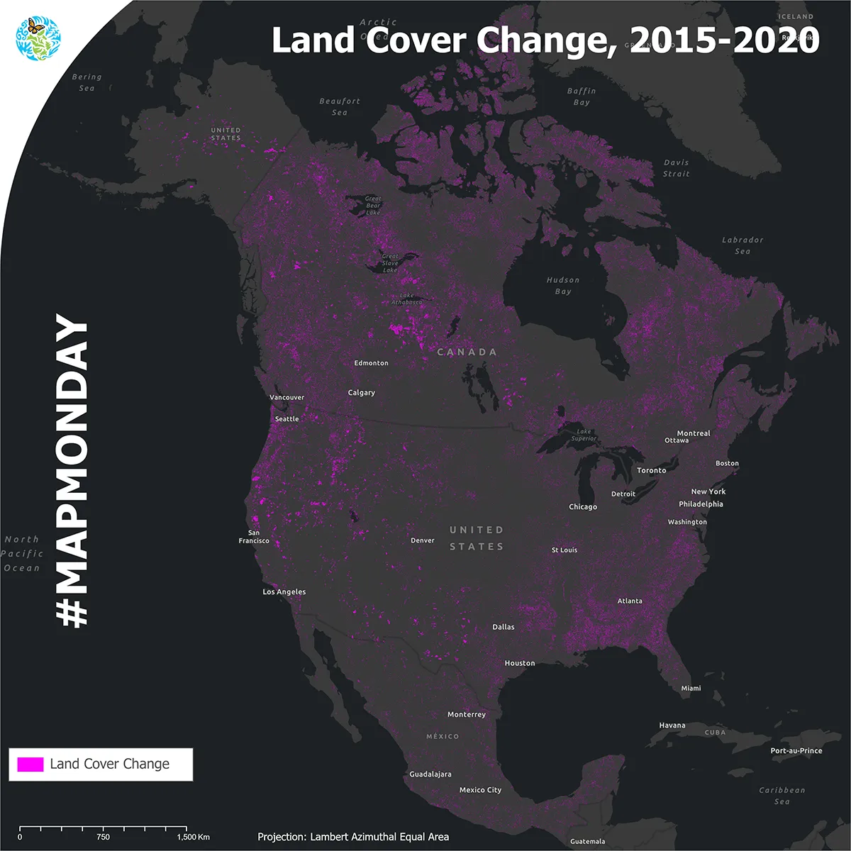
Land cover change, 2015-2020
July, 2023
Land Cover
It’s #MapMonday! The Commission for Environmental Cooperation is proud to release the 2015–2020 North American Land Cover Change #NALCMS map layer!
World Ocean Day
June, 2023
Protected Areas, Water
It’s #MapMonday! To celebrate World Ocean Day this week, the Commission for Environmental Cooperation is highlighting the North American Marine Protected Areas Network (NAMPAN) Story Map.
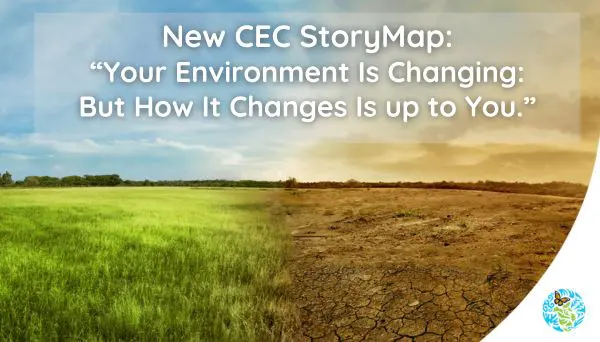
Your Environment is Changing
May, 2023
Climate, Ecoregions, Humans
It’s #MapMonday! Check out our new Story Map: “Your Environment is Changing: But How it Changes is up to You.”
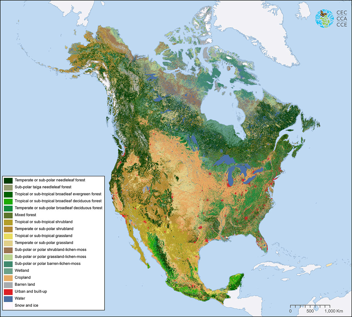
Land Cover
April, 2023
Land Cover
It’s #MapMonday! With about 24 billion pixels depicting land cover across North America at a 30-meter spatial resolution, the North American Land Change Monitoring System (NALCMS) 2020 land cover map layer is the most accurate map available for its scale.
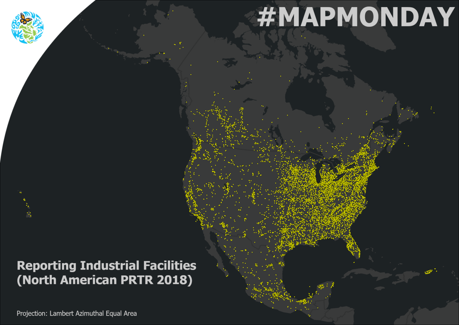
North American Pollutant Release and Transfer Registers
March, 2023
Pollutant Releases and Transfers
It’s #MapMonday! #DYK that approximately 24,000 industrial facilities report their releases (e.g., to air or water) and transfers (e.g., to recycling or disposal) to the North American Pollutant Release and Transfer Registers (#PRTR) every year?
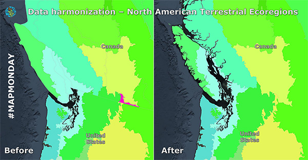
Data Harmonization
February, 2023
It’s #MapMonday! Today we’re exploring how we take geospatial data from each North American country, which do not always start out as directly comparable, and harmonize it to create a continental map.
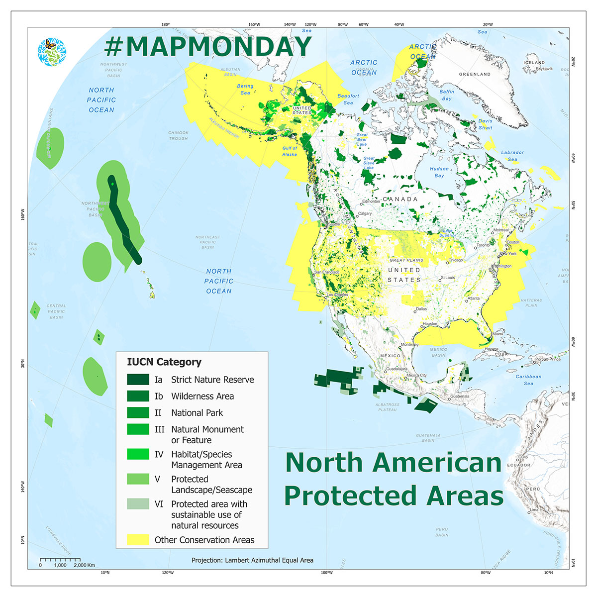
Protected Areas
December, 2022
Protected Areas
It’s #MapMonday! Did you know that Protected Areas are a key focus of the Convention on Biological Diversity UN Biodiversity and a priority agenda item for the upcoming #COP15 Conference of the Parties?
Contact Us
Be the first to hear when we publish new GIS data and updates. We promise we won’t send you anything else.
Dominique Croteau
Project Lead, Geospatial and Environmental Information
(514) 350-4307