NAAtlas
It’s #MapMonday! #DYK that Commission for Environmental Cooperation created the North American Environmental Atlas (#NAAtlas), a collection of publicly accessible harmonized geospatial data layers at the continental level that is used for research, environmental management, and decision-making?
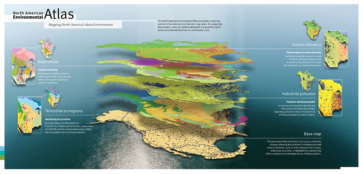
The #NAAtlas is a collection of geospatial mapping products that supports research, analyses, and management of environmental issues in Canada, Mexico, and the United States.
It provides access to harmonized, seamless and accurate geospatial data at the North American level that is used by decision-makers, land managers, conservation organizations, scientific researchers, and international organizations in their activities. Thematic map layers allow for the visualization of various environmental aspects, such as terrestrial and marine ecological regions, climate zones, as well as protected areas across the continent.
The online map viewer of the #NAAtlas is constantly updated when new information is made available, often in collaboration with external high-level expert groups such as the North American Forest Commission or the North American Marine Protected Areas Network (NAMPAN).
Learn more about the North American Environmental Atlas: